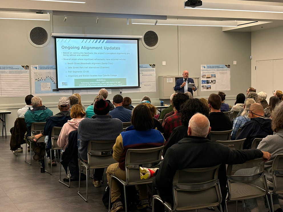
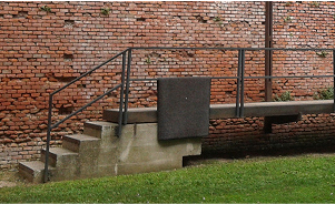
 Community Workshop presentation, Santa Cruz
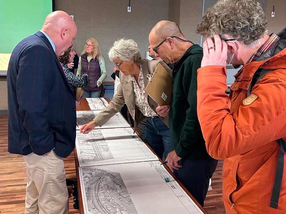 Community Workshop, Watsonville
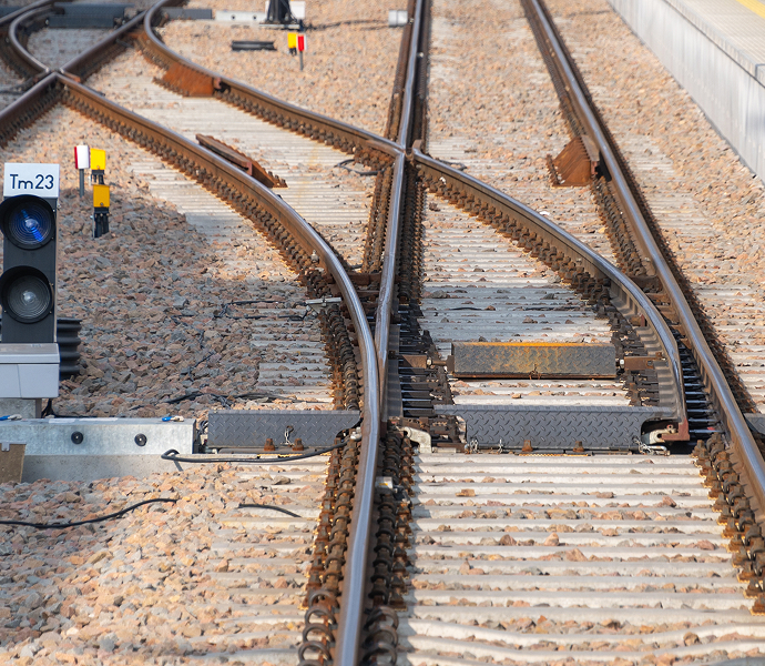
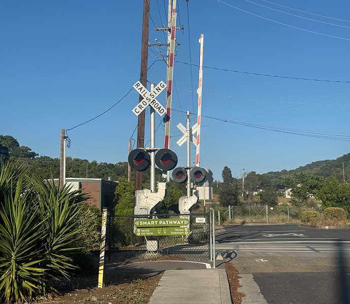
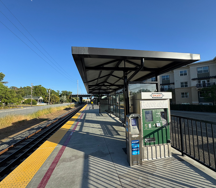
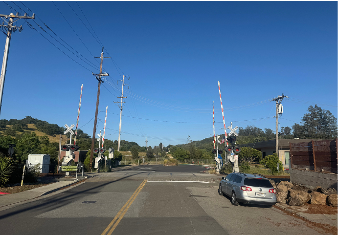
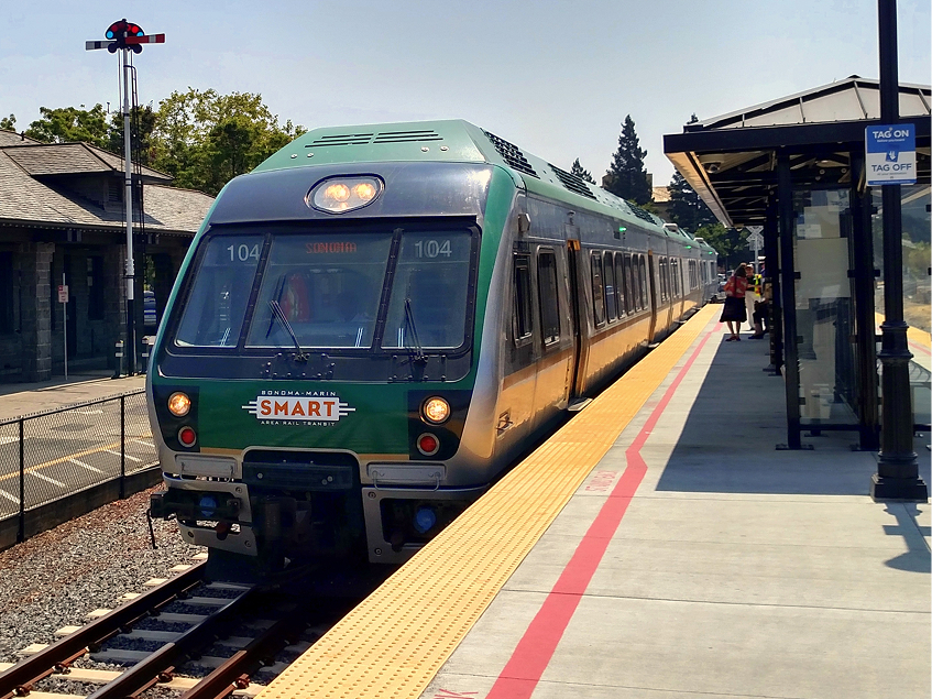 SMART (Sonoma-Marin Area Rail Transit)
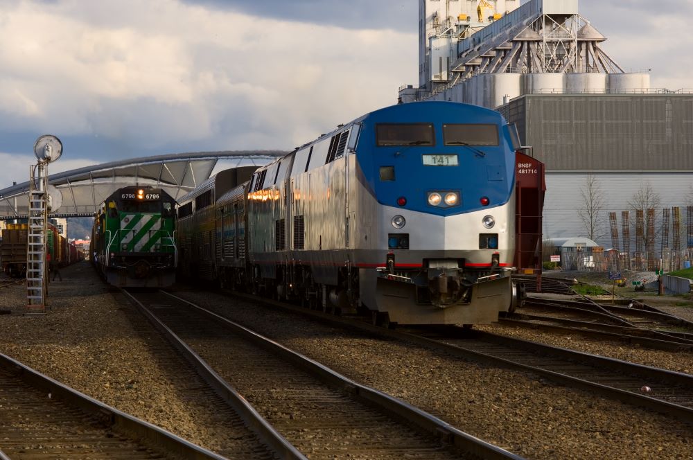
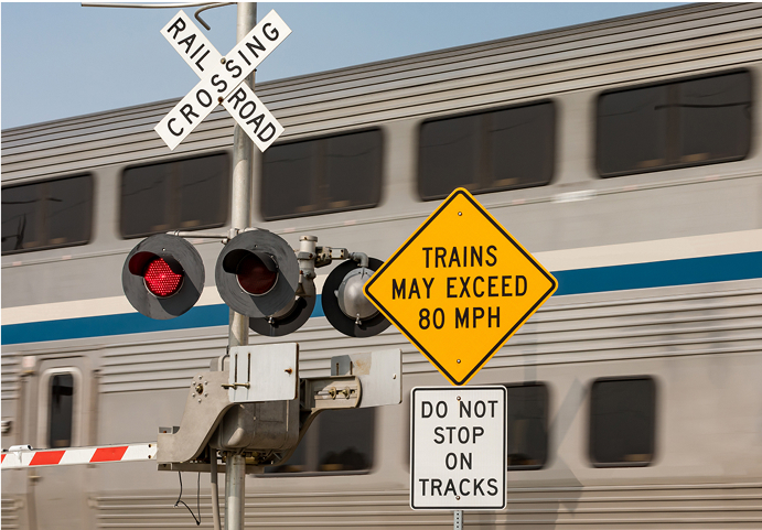
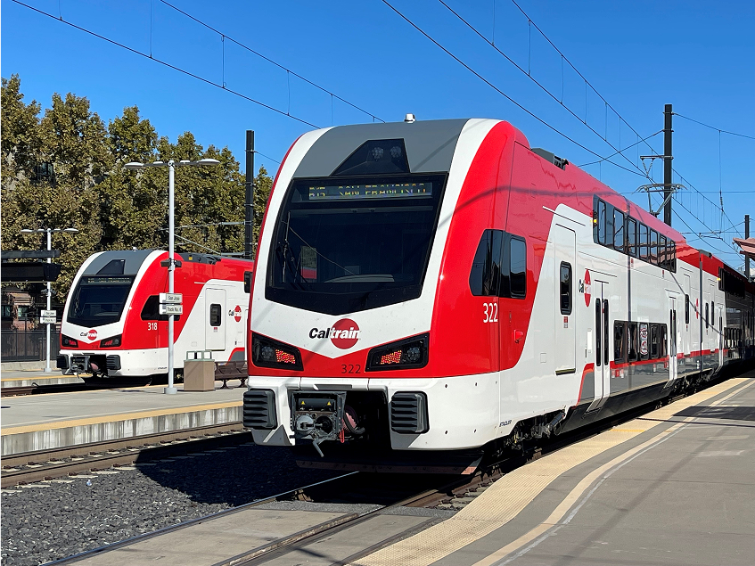 Caltrain (San Francisco Bay Area)
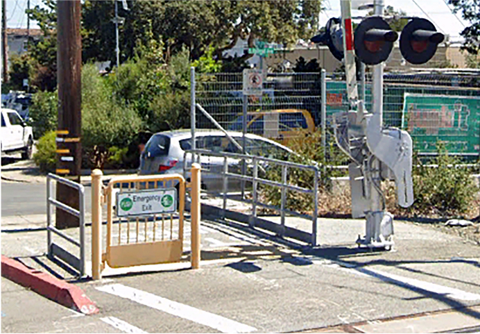
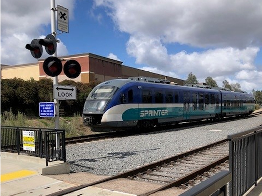 SPRINTER (North County Transit District, San Diego)
Learn more
To dive deeper into potential next steps and funding opportunities for the ZEPRT project, refer to Chapter 20 of the Final Project Concept Report, located on the project webpage at sccrtc.org/zeprt under the “Resources” section.
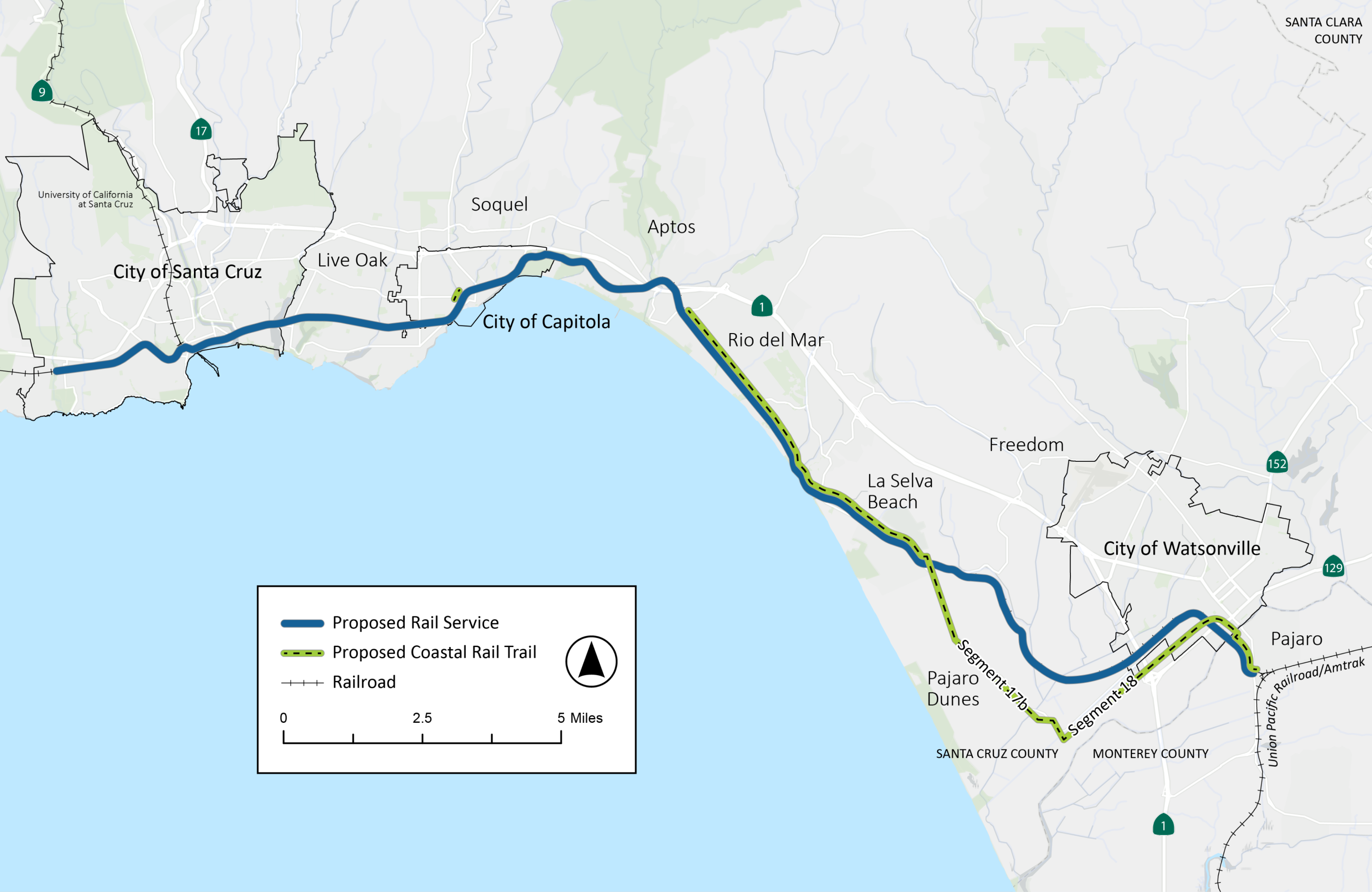
The ZEPRT project proposes new passenger rail service and stations on approximately 22 miles of the Santa Cruz Branch Rail Line (Branch Line) from the city of Santa Cruz in the north to Pajaro, just south of Watsonville. The project also proposes to develop 12 miles of Coastal Rail Trail: Segments 13-20 from Rio del Mar Boulevard through the community of La Selva Beach and the city of Watsonville, as well as the Capitola Trestle portion (Segment 11, Phase 2).
Benefits of the ZEPRT Project could include the following, which would be further analyzed and quantified during future phases of project development:
Click to enlarge
The project builds on studies previously completed by the RTC, including the Rail Transit Feasibility Study in 2015 and the Transit Corridor Alternatives Analysis & Rail Network Integration Study in 2021, which identified a locally preferred alternative for Electric Passenger Rail. The project name has been changed to allow the project to explore other existing and emerging technologies in addition to electrification that will also achieve the goal of zero emissions.
The Final Project Concept addresses the project's Purpose and Need that was developed with community input in early 2024 during Milestone 1 virtual and in-person engagement. The Purpose and Need Statement outlines the project background, needs and fundamental purpose to support and improve equitable multimodal transportation options in Santa Cruz County.
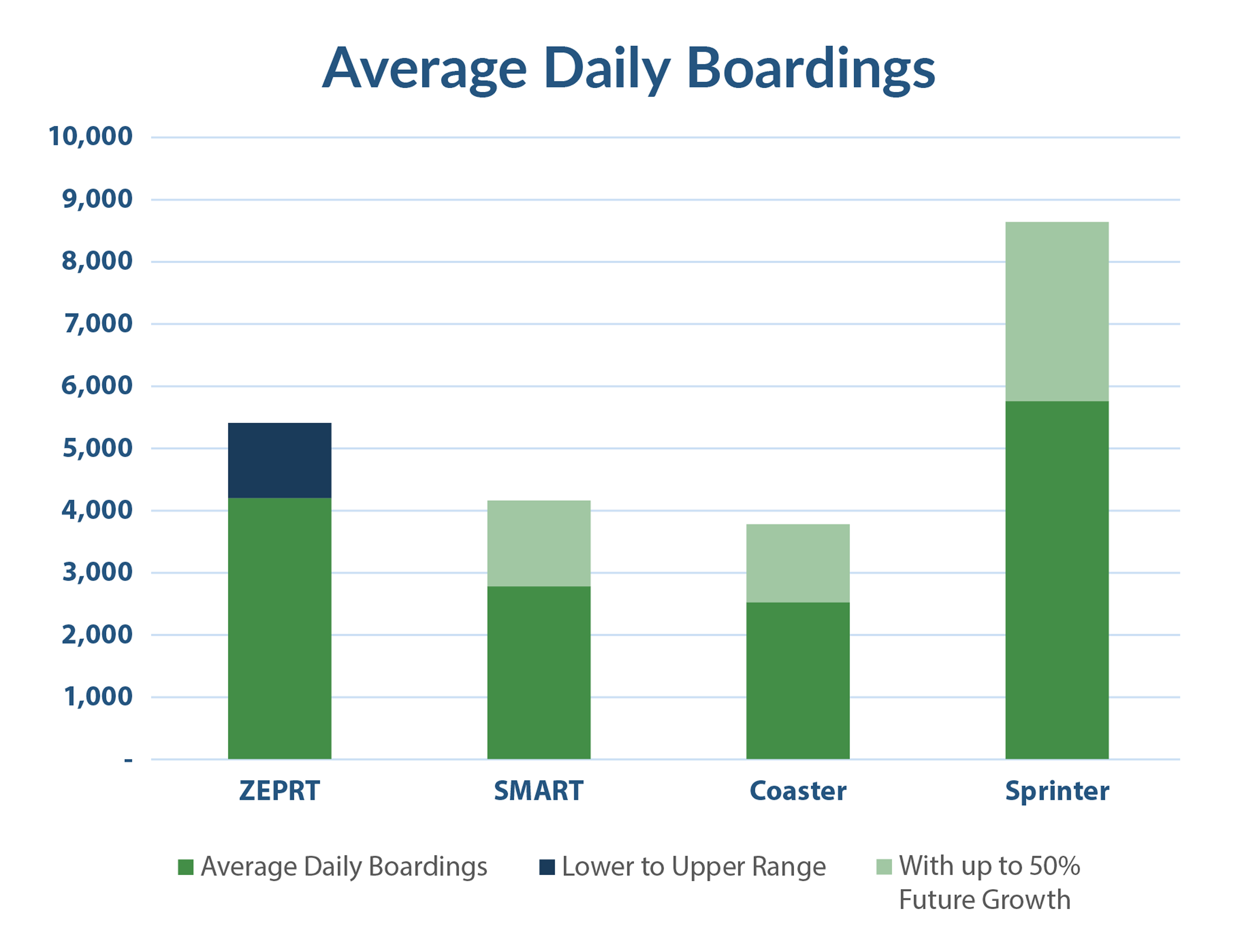
Typical ridership is estimated at 4,200-5,400 boardings (each time a passenger steps aboard the rail vehicle) per weekday during first years of rail service (Updated estimates based on refined results from the Direct Ridership Model process. Ridership will continue to be refined as ZEPRT project advances). This estimate was prepared using community and transportation data sources, and anticipates areas of planned growth.
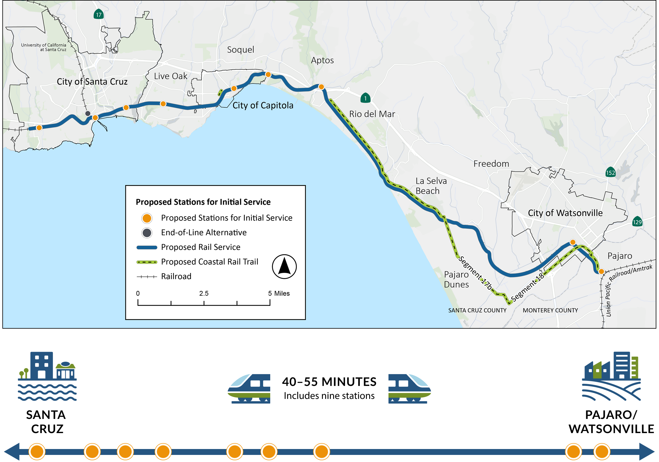
The Project Concept has identified nine stations for initial service. Assuming 60 second dwell times (amount of time train stops at each station), total system end-to-end (Pajaro to West Santa Cruz) travel time is estimated at approximately 40-55 minutes. Alignment revisions reduced projected vehicle speeds in certain locations and affected timing of passing sidings. Ongoing planning and design work will explore opportunities to better accommodate train meet-pass events to reduce estimated end-to-end travel time.
Capital costs include design and construction of rail and associated infrastructure. Total capital costs are estimated at approximately $4.28 billion (2025 dollars). Costs will be further refined as decisions are made related to alignment options and other infrastructure improvements in the Beach Street/Beach Flats area of Santa Cruz.
Operating costs include the expenses to operate and maintain passenger rail service once constructed. These costs are typically calculated annually. Operating expenses for rail service running every 30 minutes are estimated at an average annual range of $34 to $41 million (2025 dollars) with and without a +20% contingency, which accounts for variables of historical experience of Santa Cruz METRO labor agreements and the uncertainty around hydrogen-fueled train operations.

The RTC Commission will consider the Project Concept Report and next steps for advancing the development of the ZEPRT project in late 2025. With the Commission's approval, and subject to available funding, the ZEPRT project would continue to advance through the Caltrans Corridor Identification Program into preliminary engineering and environmental review.
In alignment with the California State Rail Plan, the proposed project would be integrated into the statewide rail and transit network that provides comprehensive and coordinated service to passengers.

Click to enlarge
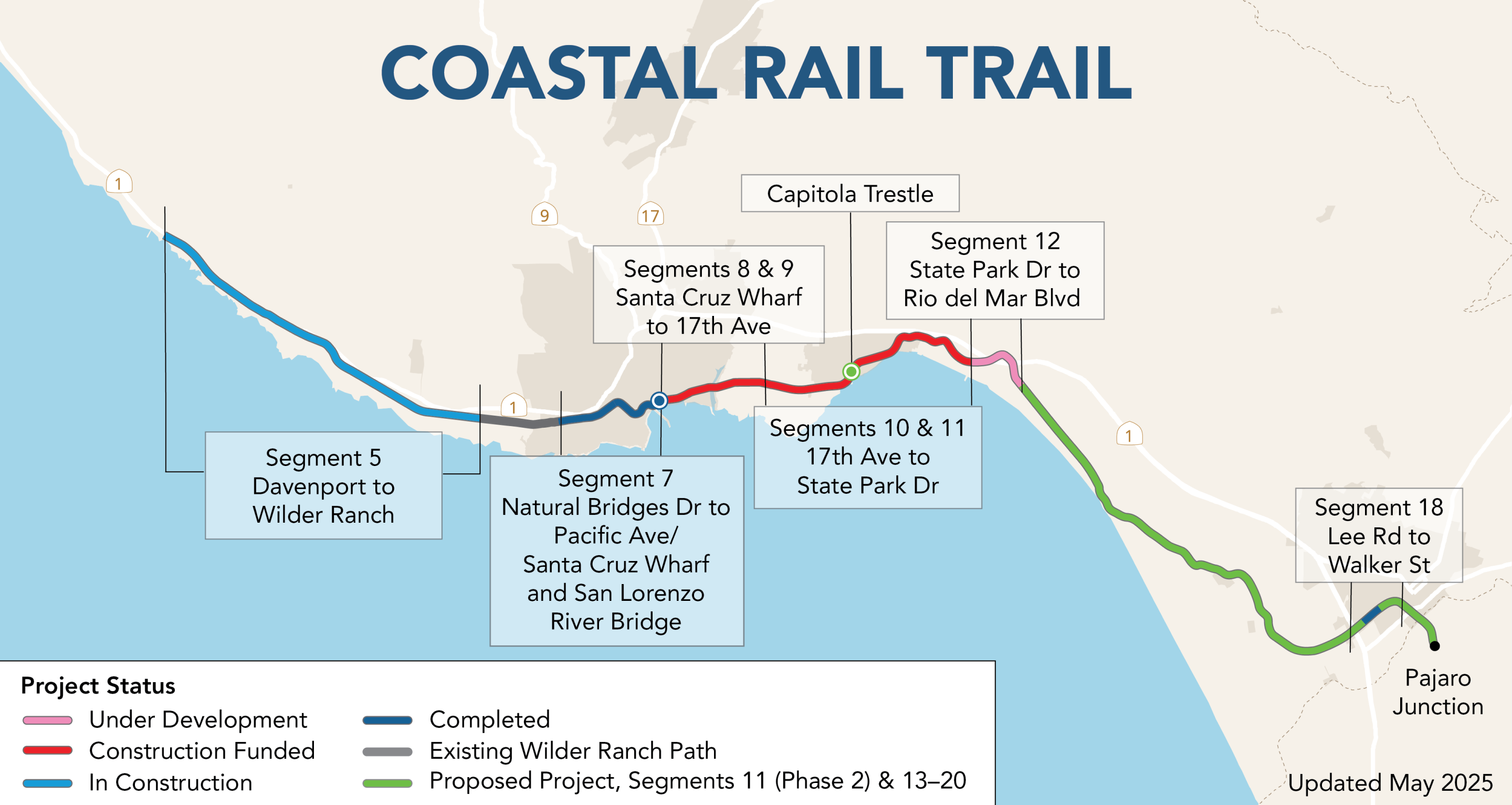
Included in this project are 12 miles of Coastal Rail Trail: Segments 13-20 from Rio del Mar Boulevard through the community of La Selva Beach and the city of Watsonville, as well as the Capitola Trestle portion (Segment 11, Phase 2).
The map below shows the status of Coastal Rail Trail projects, many of which are being implemented by others as separate projects along the Branch Line.
Click to enlarge
From project inception, RTC and its project partners have focused on creating engagement opportunities for information exchange, convenient participation and ongoing input gathering. Since early 2024, we have connected with hundreds of community members and dozens of key stakeholder groups, reached thousands through virtual events, and consistently worked to share project information and gather input.
Throughout the many ZEPRT outreach events and touchpoints, engagement has focused on key topics critical to the project's concept development. We have collected over a thousand comments from community members via the project website, email, events, open houses and informational sessions. We have also gathered hundreds of input points through interactive engagement activities like surveys, map comments and interactive posterboards. Explore below the key feedback themes we've heard related to each topic.
Click through the rest of this Virtual Open House to see how community input received to-date has played a crucial role in shaping the development of the ZEPRT's Final Project Concept!
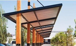
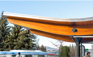
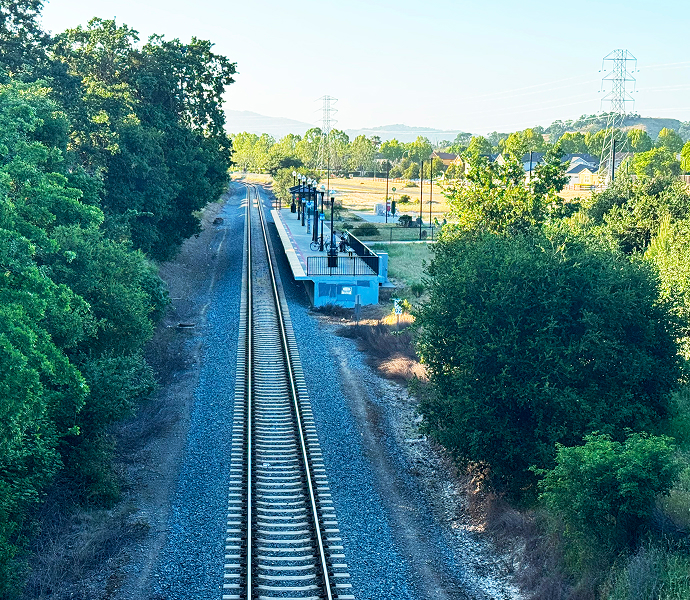
Intercity service is intended to serve travelers within Santa Cruz County providing connections to other communities in the region as well as in California. The service meets the needs of people traveling shorter trips as well as longer trips through a limited number of stations that support a competitive travel time between Watsonville and Santa Cruz. See photos below of examples of intercity rail services in other parts of California.
The decision to pursue intercity rail service:
The ZEPRT project's funding outlook changed at state and federal levels since initiation of the Project Concept development in 2022 due to:
Unlike previous federal planning efforts, the Corridor ID Program supports sustained development of intercity passenger rail and establishes a pipeline of rail projects for federal funding. Caltrans is the grantee for the initial Corridor ID service planning funds to implement planning development in accordance with the State Rail Plan for new service on the Central Coast Corridor, which includes the Branch Line. To maximize federal investments, the state is prioritizing funding capital projects and pre-construction planning activities that align with federal transportation priorities and the State Rail Plan.
Funding is available for project components including:
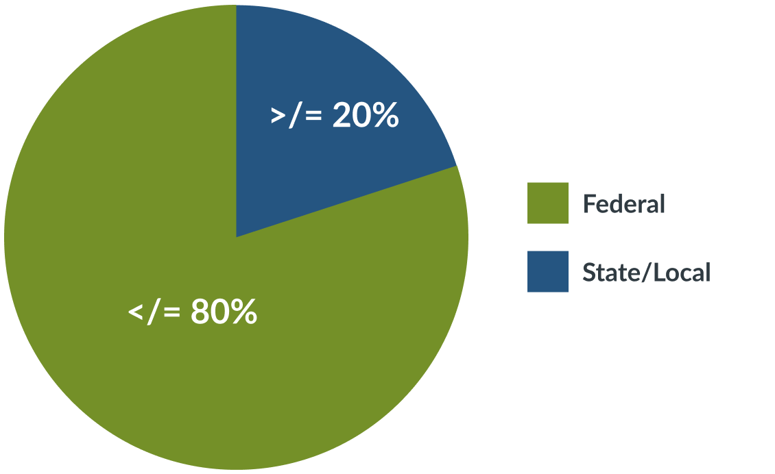
While many federal grants offer up to 80% maximum contribution, oversubscribed discretionary programs require federal agencies to spread out amounts less than requested. A local funding source, similar to a tax measure like Measure D, would be needed to supplement federal and state funding.
To learn more, view the following resources:
We have worked with local partner agencies to evaluate ridership and our ridership modeling has taken into account community destinations as well as areas of planned growth. Evaluating ridership relies on data from a number of sources. The project team has collected data from Santa Cruz County, UC Santa Cruz, cities of Watsonville and Santa Cruz, Santa Cruz METRO, Visit Santa Cruz and others.
Analysis was prepared using a combination of the Santa Cruz County Travel Demand Model (SCC Model) and a Direct Ridership Model (DRM). Utilizing a combination allows the ZEPRT project team to leverage strength of both tools to have a regional understanding of travel patterns paired with detailed land use and circulation factors around potential station areas.
Regional travel demand model forecasting travel throughout Santa Cruz County and to/from adjacent counties. The model considers existing and projected land uses as well as travel characteristics within the county.
Ridership levels and travel patterns can increase and change over time based on population and employment density changes as well as transportation system changes. The ZEPRT project ridership modelling and ridership projections focus on a 2045 horizon year, consistent with the SCC Model.
An added activity that complemented the SCC Model by incorporating more detailed location information, such as type and intensity of land uses around stations, parking supply, levels of bus transit access, etc.
View the October 28, 2024 Informational Community Session that explains the different ridership models considered and how they will be applied.
View the June 9, 2025 Informational Community Session that provides further details regarding ZEPRT ridership projections and cost estimates.
Total system ridership projections are based on the ridership ranges projected at each station. Ridership numbers are presented as the number of boardings, which means each time a passenger steps aboard the rail vehicle. A ridership range is presented based on a number of factors related to future development, transit connections, etc. that would impact the number of riders at each station.
| Station Name | Preliminary Ridership Ranges (In Boardings) | ||
|---|---|---|---|
| Weekday | Weekend | Notes | |
| Pajaro | 350 – 450 | Low | Interregional connection |
| Downtown Watsonville | 900 – 1,100 | Med | Accounts for Downtown Watsonville development |
| Aptos Station | 250 – 400 | Med | |
| Cabrillo (south) / State Beach | 350 – 450 | Med | Higher ridership if new connection to Cabrillo College built |
| Capitola Station | 450 – 550 | High | High weekend activity |
| 17th Ave Station | 400 – 500 | Med | |
| Seabright Station | 300 – 400 | Med | |
| Beach Station | 1,050 – 1,300 | High | Highest activity station, potential UCSC connection |
| Natural Bridges Station | 150 – 250 | Med | Higher ridership with improved UCSC connection |
| Total | 4,200 – 5,400 boardings/day | Updated estimates based on refined results from DRM process. Ridership will continue to be refined as ZEPRT project advances. | |
The ridership results by station are mapped here. The size of the blue circle indicates projected ridership range.
 Click to enlarge
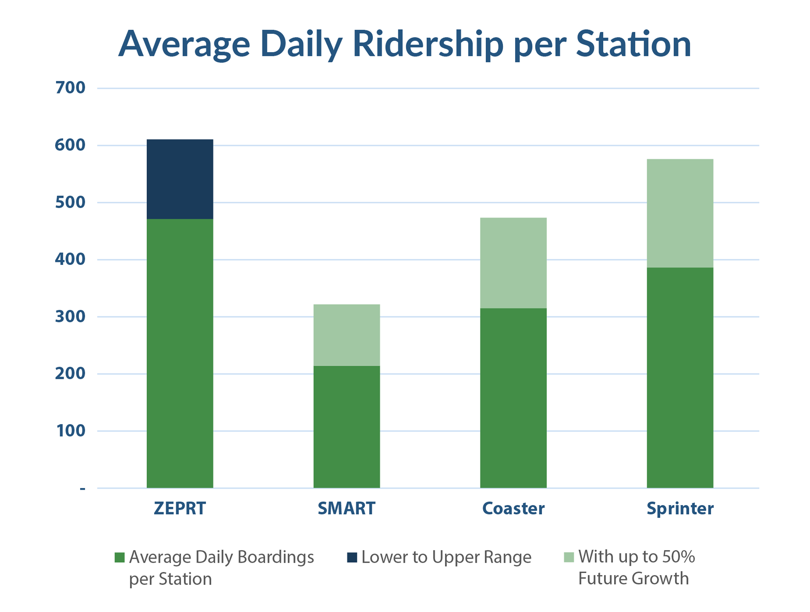
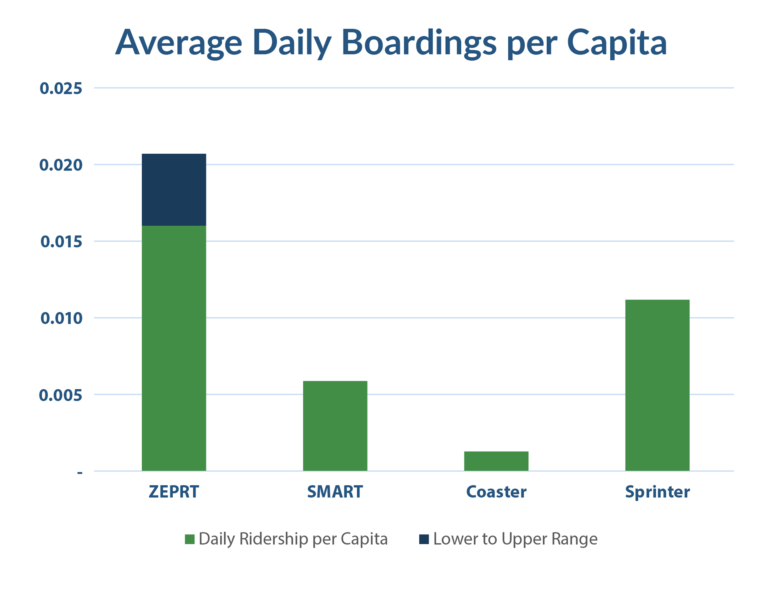
The following tables compare the proposed ZEPRT system to other operating passenger rail systems in California in terms of the total daily boardings, per station basis and per capita basis. The comparisons include three systems: Sonoma Marin Area Rail Transit (SMART), and the COASTER and SPRINTER services in San Diego County.
 Click to enlarge
 Click to enlarge
 Click to enlarge
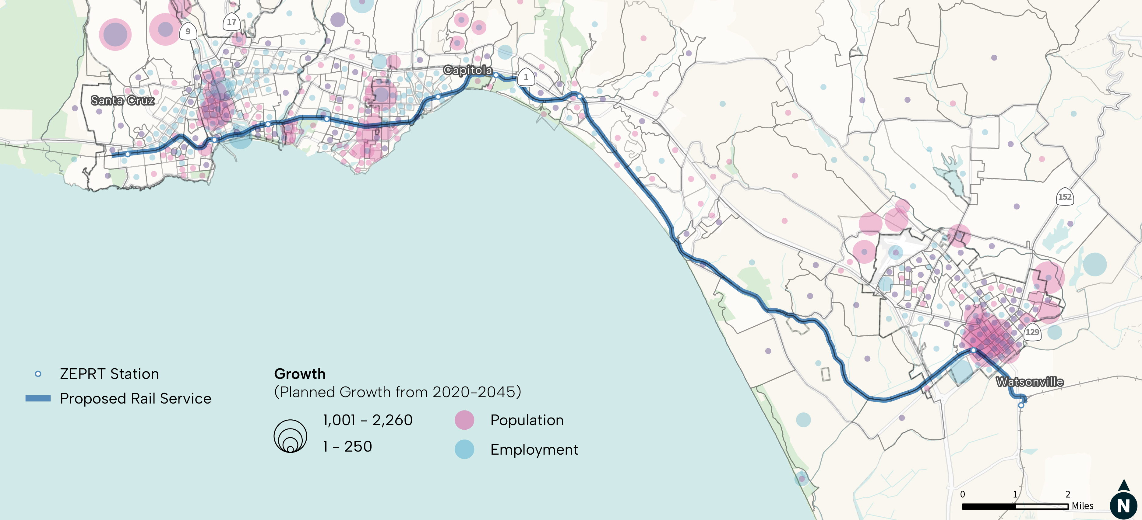
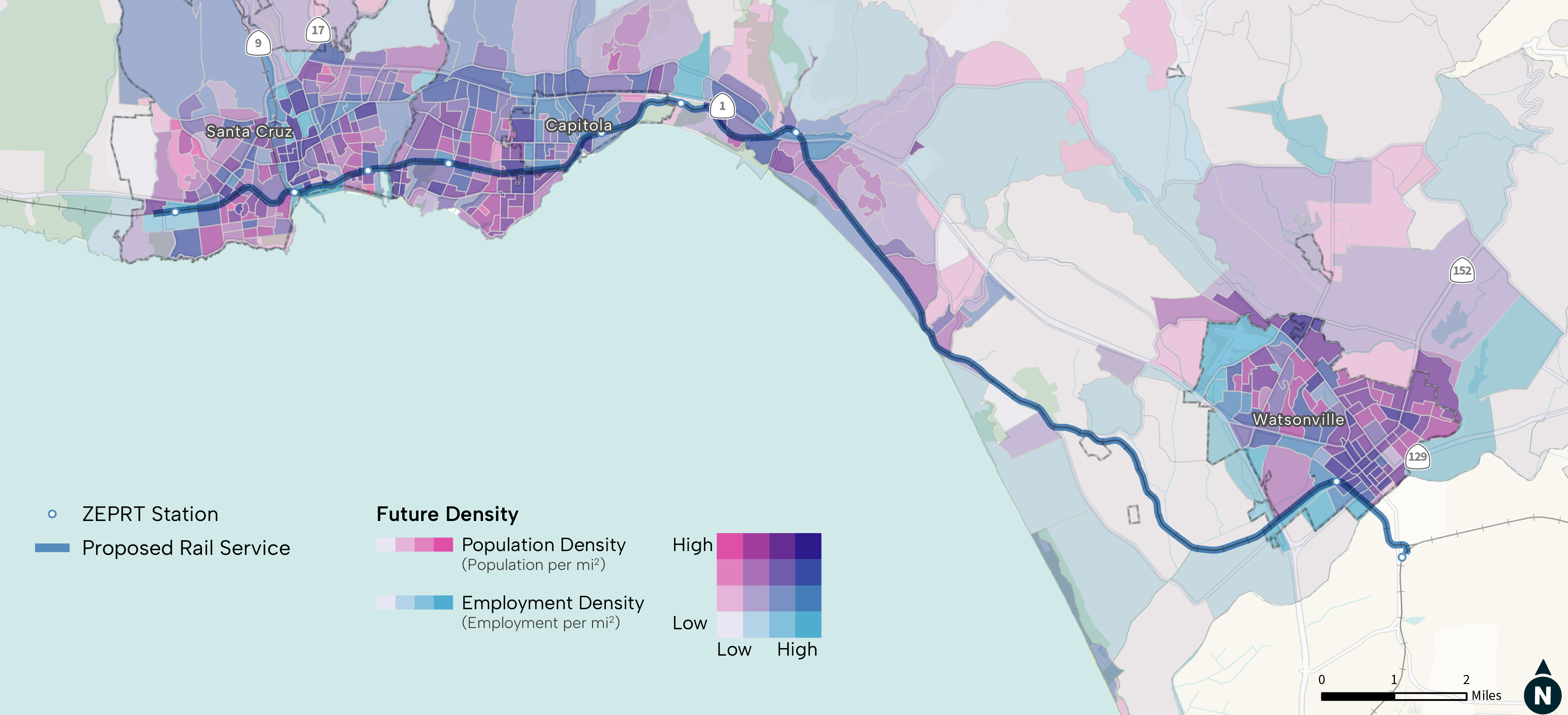
The ridership modeling considered how future growth might occur in the corridor and the population and employment changes that might contribute to ridership.
 Click to enlarge
The ridership modeling considered future growth projections for 2045. This map shows growth along the corridor on a density basis, including both population and employment density.
 Click to enlarge
The State Rail Plan envisions rail service connecting to the statewide system at Pajaro. Ridership modeling assumes that about 10% of ZEPRT riders would connect at Pajaro to other systems or get on at Pajaro and travel to locations within Santa Cruz County. Transfers heading north to Gilroy and the Bay area are expected to be higher than transfers traveling south.
 Click to enlarge
Potential strategies have been identified that could be considered as the project design advances to allow the system to achieve the higher end ridership projections. These include the improvements noted below, such as timed transfers to other transit systems, bike parking and pedestrian access, etc.
| Station Name | Potential Improvements |
|---|---|
| Pajaro | Park and ride, timed transfers |
| Downtown Watsonville | Bike parking, connections to new housing; park and ride |
| Aptos Station | Pedestrian access improvements |
| Cabrillo (south) / State Beach | New direct walk/bike connection to Cabrillo College, sidewalks, bike infrastructure, park and ride |
| Capitola Station | Better access to downtown, sidewalks on Park Avenue |
| 17th Ave Station | Bike parking; pedestrian access improvements |
| Seabright Station | Better sidewalks on Murray Street |
| Beach Station | Direct bus connections, wayfinding/access improvements |
| Natural Bridges Station | Direct bus connections, bike parking, bike infrastructure |
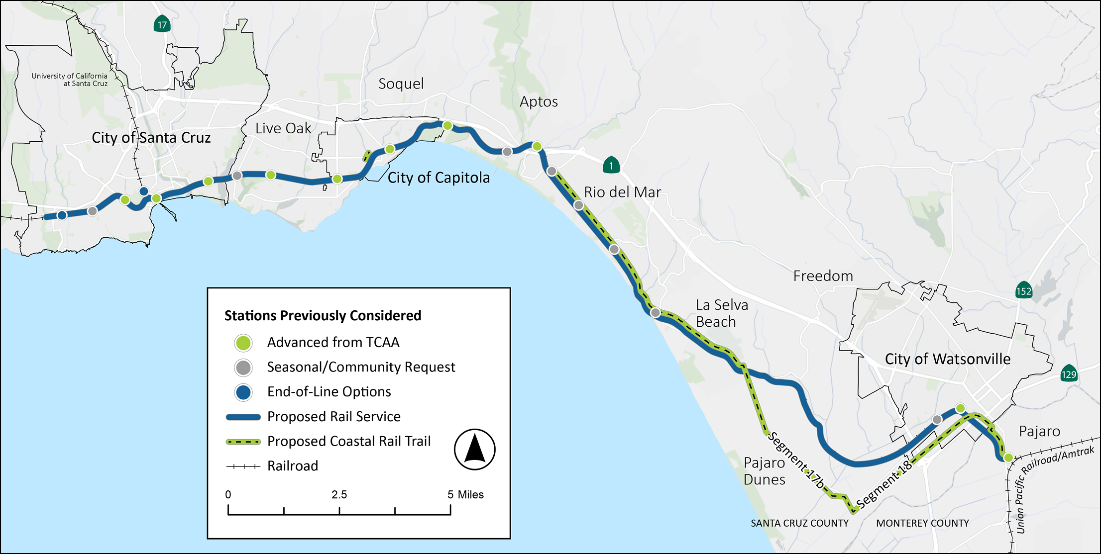
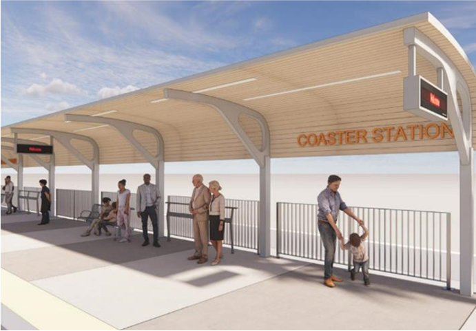
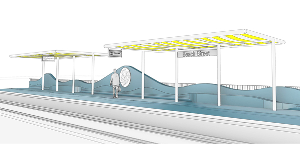
Throughout the ZEPRT planning process, a number of station locations were considered, including those advanced from the Transit Corridor Alternatives Analysis, identified by community request or for seasonal/beach access and options for the end-of-line service. The platform, design and basic features will be consistent across stations, but the layout and additional features like those shown below will vary.
Click the map tabs below to see the stations being proposed for initial service and stations that were previously considered.
The layout and amenities at each station would vary based on location and the way riders access the station. The platform, design and basic features will be consistent across stations, but the layout and additional features, such as those shown below, will vary.
Bicycle parking
Parking
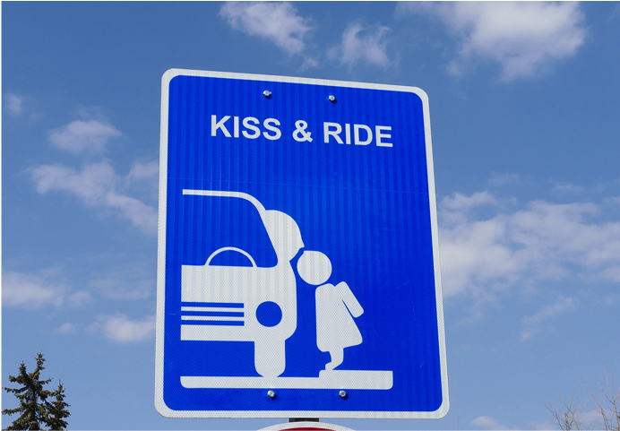
Kiss and Ride
Connections to Coastal Rail Trail
Shelter

Seating

Ticket vending
Wayfinding / public information
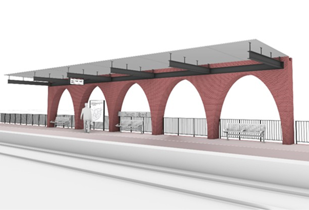
A user-centered design concept has been developed to represent the community and its people through the following design pillars:
In addition to considerations for station locations, platform size, building standards and rail system requirements, design features will incorporate several other considerations:
The images shown here represent conceptual design components developed at this stage for cost estimating purposes. The system would have a consistent station design theme, however, individual stations could incorporate unique elements to represent neighborhood character.
View the July 22, 2025 Informational Community Session that showcases three conceptual designs developed to represent the community and its people, while providing needed station features and a cohesive system-wide identity.
Constructed of wood, this shelter evokes a connection to the redwoods and maritime environment.
Wood—as a common element of the shelter, benches, trash cans and signage—makes system easily identifiable, reducing traveler stress and enhancing both safety and operational efficiency.
Wood, as a renewable resource, connects people to the things that are memorable—the beach, the Boardwalk and surfboards.
A light-filtering structure resonates with the unique quality and intensity of light in Northern California.
Both natural and artificial light enhance station visibility and wayfinding, creating system-wide continuity and an environment that is easily identifiable, legible and intuitive to navigate.
A simple structure combining a breezy light-filtering canopy providing travelers with a public space reminiscent of beach umbrellas and the Monterey Bay shoreline.


The use of brick or terracotta nods to the historic rail and industrial character infrastructure connecting the natural landscape with the station's surrounding public realm.
A clear, though distinguishable, system-wide identity can be achieved through Victorian era rail infrastructure to achieve a strong contemporary yet timeless identity.
Materials such as brick or terracotta, marine bronze and picketed balustrades create familiar architectural elements such as arcades, porches, and patterned brick flooring fostering familiarity, legibility and a heightened sense of hospitality that connects travelers to the craft, history and the passage of time.

Preliminary conceptual operations modeling developed for ZEPRT estimates end-to-end travel time over a 22-mile single-track route for daily passenger rail service on the Branch Line.
The ZEPRT project will use multiple unit trains (such as the zero-emission Stadler FLIRT) as they are most compatible with the Branch Line service.
Service of the FLIRT multiple unit vehicle was recently launched
View Example VideoCaltrans and North County Transit District are currently procuring multiple unit vehicles to provide passenger service along corridors similar to the Branch Line
Photo Source: NCTD
View Example VideoOperators in other states are also using multiple unit vehicles
Photo Source: DART
View Example VideoThe number of vehicles needed for Branch Line service will be based on ridership demand forecast and requirements for a time-competitive service operating between Pajaro and Santa Cruz. Conceptual operations planning identified a fleet size of five vehicles to accommodate regularly-scheduled 30-minute service, including spares for vehicle maintenance. Fleet requirements will be confirmed as the ZEPRT project advances.
To learn more, view a recording of the April 1, 2025 Informational Community Session, which includes content on the Rail Vehicle Concept.
Recording of the April 1, 2025 Informational Community Session
Infrastructure improvements needed to support a safe, efficient and reliable passenger rail service could include any or all of the following:
New or rehabilitated rail and track structure (main track, side track, connections to other railroads)
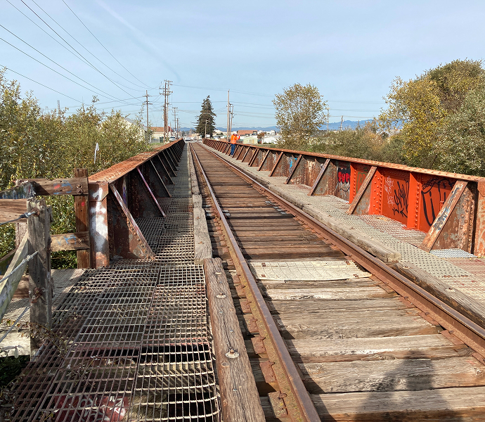
New or rehabilitated bridges or drainage culverts
Train control systems
Active warning devices and interface at public highway-rail and pedestrian-rail grade crossings
Stations, platforms and more
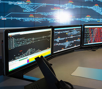
Operations control center
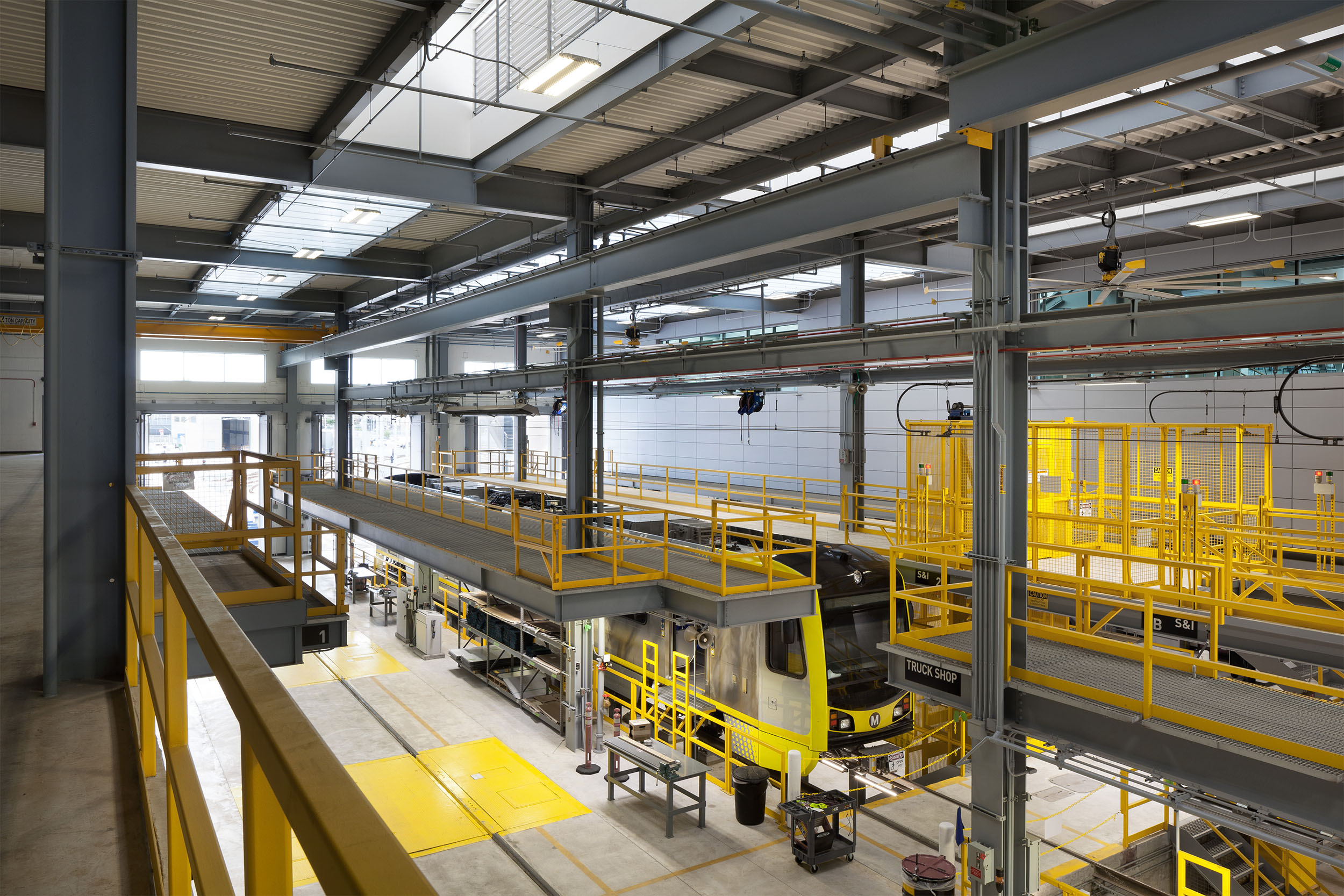
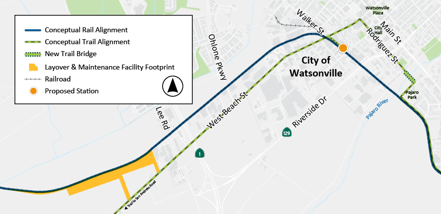
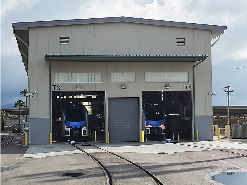
Layover & Maintenance Facility
To learn more about railroad bridge infrastructure assessments, view a recording of our Informational Community Session from March 12, 2025.
Recording of our Informational Community Session
A layover & maintenance facility allows for storage of vehicles and maintenance equipment and materials, and for operators to carry out essential maintenance tasks to ensure trains are safe and in optimal working condition. This may include cleaning, inspection, or repairing various components as well as refueling hydrogen tanks or recharging batteries.
A conceptual facility site has been identified in the Watsonville area west of Highway 1 off of the Branch Line corridor. Refer to the map below.
 Click to enlarge
 San Bernardino County Transportation Authority
Metrolink Arrow Maintenance Facility in San Bernardino,
California
San Bernardino County Transportation Authority
Metrolink Arrow Maintenance Facility in San Bernardino,
California
The initial conceptual alignment, presented in summer 2024, was designed to fit in the existing rail corridor where feasible while accommodating both the rail and trail and also optimizing operations to allow for train travel speeds that would reduce end-to-end system total travel time.
Since then, refinements to the proposed rail and trail alignments have included:
Based on these refinements and ongoing coordination with stakeholders and interested parties, the following describes where the proposed alignment has changed.
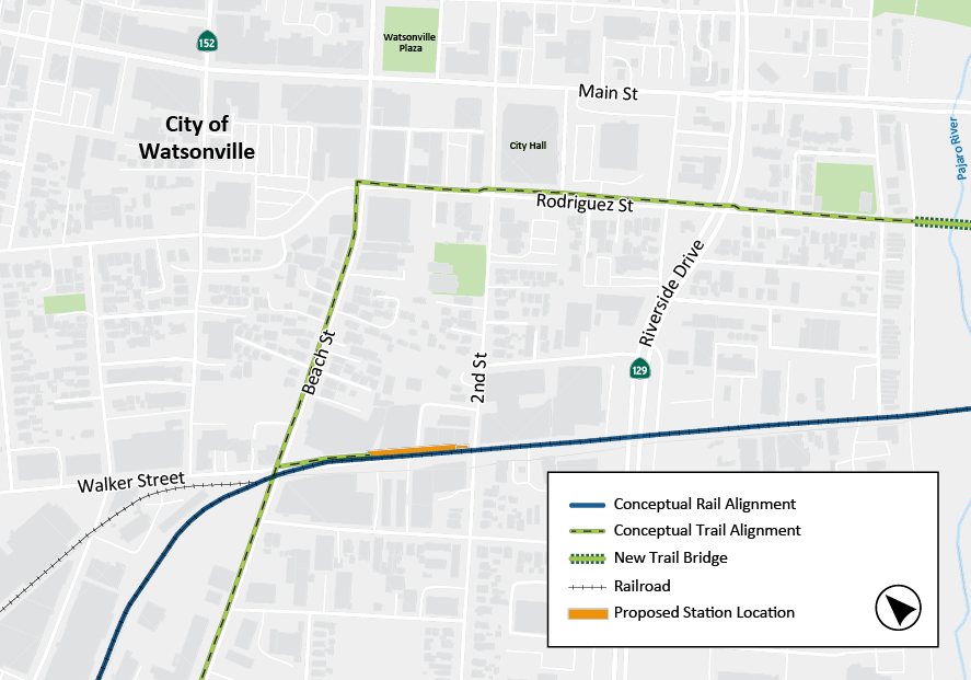
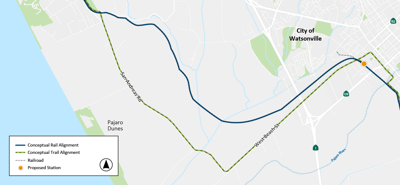
Shifts rail from center of the roadway to the mountain (north) side of Walker Street. This change allows for maintained pedestrian and vehicle movement on Walker Street, including two lanes of vehicle traffic while maintaining business access to the extent feasible and minimizing impacts to parking. This alignment also accommodates the proposed Downtown Watsonville Station to be located on Walker Street between W. Beach Street and 2nd Street. Future design refinements, however, would not be precluded from exploring alternative locations for the Downtown Watsonville Station, including other areas along Walker Street or the Historic Depot.
 Click to enlarge
Routes the trail out of the constrained rail corridor onto San Andreas Road (near the intersection with Buena Vista Dr.) to W. Beach St. The trail would follow W. Beach into Downtown Watsonville where it would turn south onto Rodriguez Street toward the Pajaro River. This alignment allows for better access to the coast via San Andreas Road and W. Beach Street. It also improves trail safety by moving the trail away from rail crossings and prioritizing vehicle access in the industrial zone while providing better community connections from the trail to downtown Watsonville and Pajaro.
 Click to enlarge
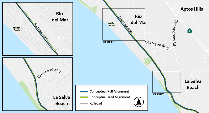
Locates a portion of the trail (Segments 13 and 14) on the coastal side of Sumner Ave. The shift from the rail corridor onto Sumner Ave. is proposed at Hidden Beach Trestle to the end of Sumner Rd. at Camp St. Francis, where the trail will return to the rail corridor. The location on Sumner Ave. provides better community access to the trail.
Trail Segment 15 continues south from Camp St. Francis on the inland side of the rail corridor to the area near Camino Al Mar where the trail will cross to the coastal side of the rail line through La Selva Bluff. To accommodate the trail on the coastal side of the rail, the rail line shifts east by several feet along the bluff.
 Click to enlarge
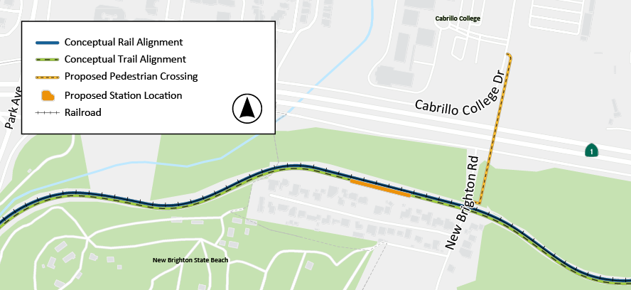
Locates an at-grade Cabrillo Station at New Brighton Road in the existing rail corridor with a proposed pedestrian crossing to Cabrillo College. This alignment and station location was found to be the least impactful to the state park, environmentally sensitive habitat areas and the neighboring communities.
 Click to enlarge
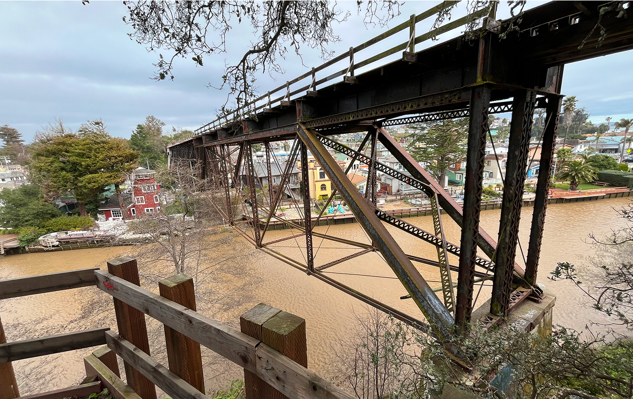
Proposes to replace the existing Capitola Trestle Bridge over Soquel Creek to serve freight and passenger service, with a trail bridge structure on the coastal side. The rail and trail bridges would be built on a new, shared bridge substructure. To accommodate the two bridge structures in the existing right-of-way, a track shift of approximately 8-feet inland would be required on both sides of Soquel Creek.
The Draft Project Concept for the Coastal Rail Trail from approximately 30th Avenue to 47th Avenue and from Monterey Avenue to Grove Lane includes the original alignment of the Monterey Bay Scenic Sanctuary Trail Network Master Plan parallel to the Branch Line. Right-of-way constraints of the rail corridor through these areas have been identified. Alternatives to address these constraints will be evaluated as the project continues to advance through the environmental process.
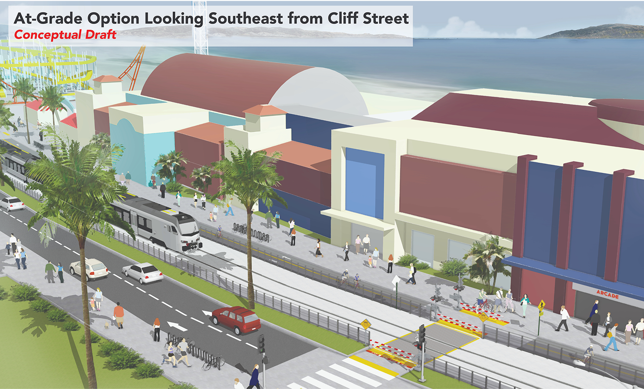
Due to high volume of pedestrian crossings and complex operational issues associated with the Santa Cruz Beach Boardwalk amusement park, various alignment options for the area along Beach Street from Cliff Street to the San Lorenzo River were developed. The baseline project assumes an at-grade alignment option for the purpose of developing the project cost estimate. Additional refinement and coordination with stakeholders will continue to address pedestrian access and safety, local roadway network changes, maintenance and emergency vehicle access, visual aesthetics and cost. Elements that would be an additional cost to the baseline at-grade rail alignment are not currently included in the ZEPRT project cost estimate.
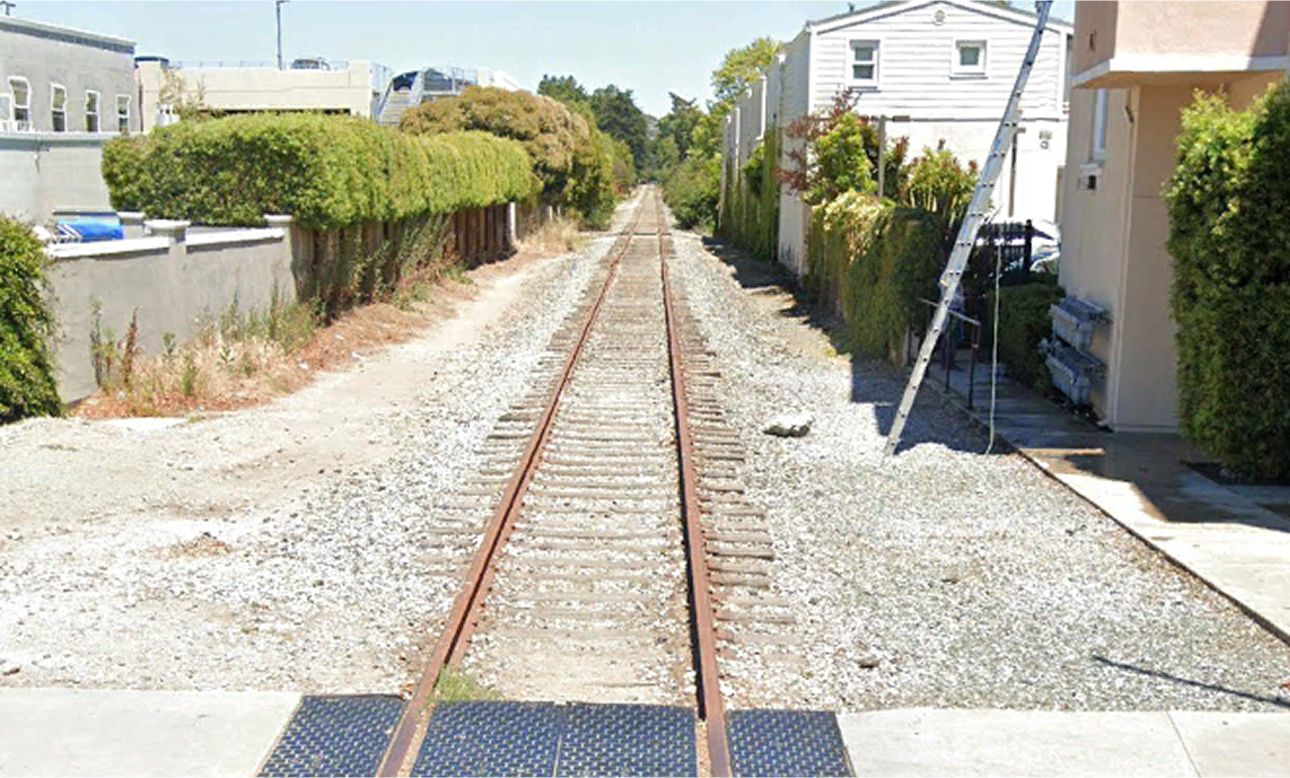
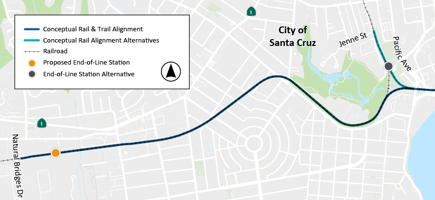
Proposes an end of the line station on the west side of Santa Cruz near Natural Bridges Dr., with an alternative end-of-line station at Depot Park. The West Side/Natural Bridges Dr. location provides service for current and future development in west Santa Cruz.
 Click to enlarge
Use the interactive map below to view the proposed conceptual rail and trail alignment and station locations. The proposed conceptual alignment below is a draft for review and discussion only showing a 24-foot rail alignment footprint (12-feet from the rail centerline in both directions) and 12-foot trail alignment footprint. The actual width of the alignments will vary. The aerial basemap displayed may not accurately depict conditions along the proposed alignment in all locations.
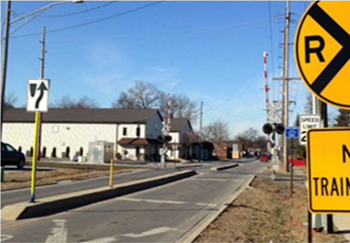
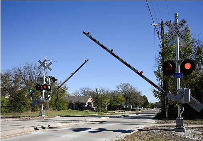
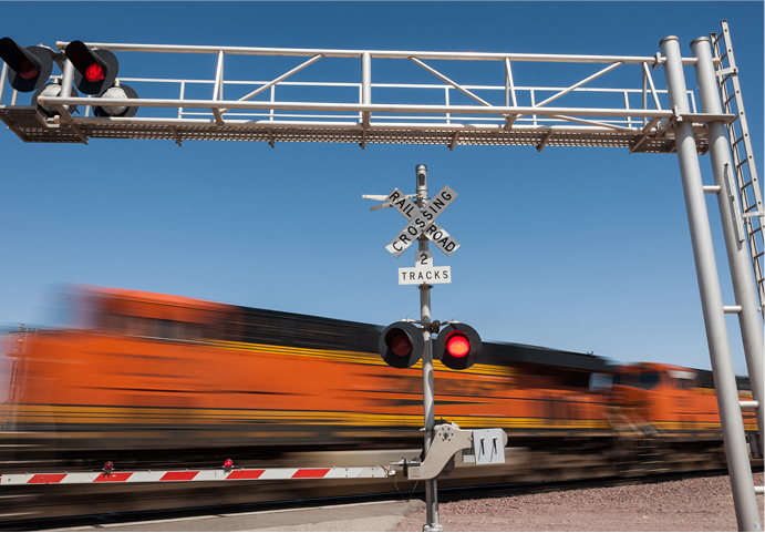
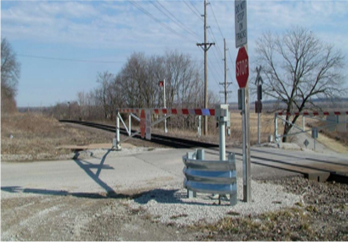
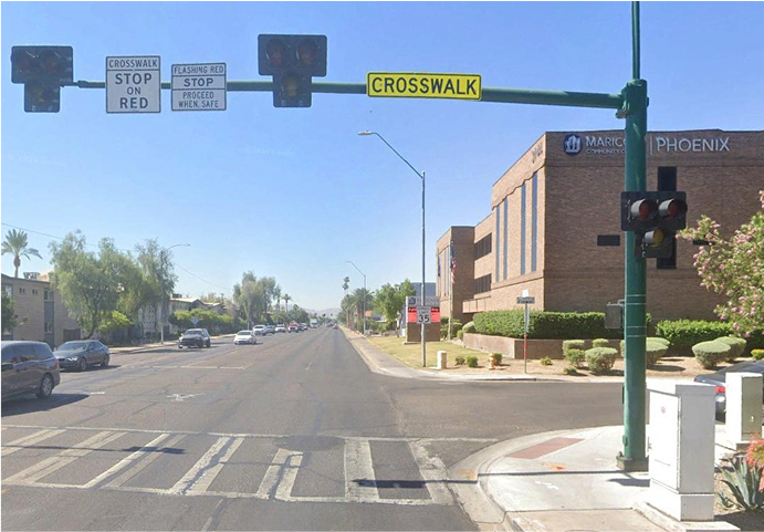
A grade crossing is where a road, street, trail or sidewalk crosses railroad tracks at the same level. The ZEPRT project has developed conceptual designs for 30 grade crossings to improve safety. The below grade crossing safety measures are among the suite of designed features that would be used to optimize safety throughout the rail corridor. While implementation of potential quiet zones will be considered in a future phase of project planning, the grade crossings have been designed to meet standards required for Quiet Zones establishment.
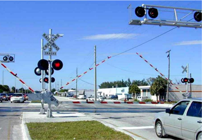
Four-quadrant gate system with center median (Source: FDOT)
Median (Source: FRA)
Median, gate and flashing lights
Gate and flashing lights
Permanent crossing closure (Source: FRA)
Pedestrian gates, railings and signs
Four-quadrant gate system
Additional signage
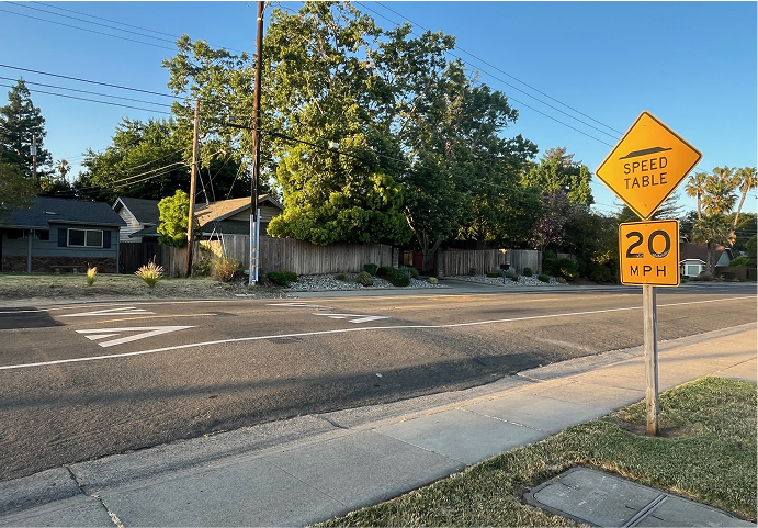
Speed table (for mid-block crossings of the Coastal Rail Trail)
High Intensity Activated Crosswalk (HAWK) (for mid-block crossings of the Coastal Rail Trail)
To learn more about grade crossings, noise and quiet zones, view a recording of our Informational Community Session from December 16, 2024.
In addition to the Interactive Comment Map above, links to current proposed conceptual alignment strip maps are provided here for your review. The maps are ordered geographically along the proposed alignment from West Santa Cruz and continuing east to Watsonville/Pajaro.
View conceptual alignment strip maps presented during Milestone 2 in summer 2024 and Milestone 4 in summer 2025 for the Draft Project Concept to compare how the proposed conceptual alignment has changed.
Capital costs are estimated using an Average Unit Bid Cost Estimate, which uses unit price data collected over a broad range of relevant local, regional and national projects, and applies the weighted average unit price to develop a rough order of magnitude cost.
The cost estimate is calculated using the FRA Standard Cost Category Workbook and is presented in 2025 dollars.
The estimated cost also includes a contingency line item typical of a project at the early phases of design. The contingency is intended to account for the risks associated with the environmental process and final design, as well as changes that may occur to the Project as development advances. As these subsequent phases advance, the contingency is a tool for the agency to account for changes that increase cost as needed, or to reduce overall project costs if risks are retired without additional costs.
Based on further refinement of the conceptual design through the Beach Street corridor, estimated capital costs would vary depending on potential structure design or infrastructure improvements.
Includes certain grading and construction costs for segments of the Coastal Rail Trail where the trail is within the rail corridor, but excludes costs for major trail structures (such as bridges) as well as costs for the trail where it is located outside of the rail corridor.
| Cost Category | Estimated Cost (Millions) |
|---|---|
| Guideway & Track Elements | $729.3 |
| Stations | $80.3 |
| Support Facilities | $253.6 |
| Sitework & Special Conditions | $740.2 |
| Systems | $152.5 |
| Construction Subtotal | $1,955.9 |
| Right-of-Way, Land & Other Improvements | $215.7 |
| Vehicles | $145.4 |
| Professional Services | $684.6 |
| Subtotal | $1,045.6 |
| Contingency | $1,283.3 |
| Total Project Cost (2025 Dollars) | $4,284.8 |
Below shows reasonable assumptions made regarding operations of the passenger rail to develop an operations and maintenance estimate.
| Category | Assumption |
|---|---|
| Service Pattern | All-day end-to-end service, a one-way trip of 22 miles |
| Operating Hours | 6:00 a.m. to 10:00 p.m. every day |
| Operating Days | 365 days per year |
| End-to-End Run Time | 45 minutes |
A benchmark cost estimate was used for operations expenses, comparing various similar transit services that operate electric or diesel multiple-unit trains on a single line. Currently no historical data is available for operation of a hydrogen powered train. Looking at similar service, operating costs vary considerably between different agencies within the same region based on when labor agreements were negotiated for their contracts.
The preliminary rough order-of-magnitude cost estimate to annually operate and maintain the ZEPRT service between Santa Cruz and Pajaro is presented below in 2025 dollars, based on transit industry averages for peer U.S. operations in the Federal Transit Administration (FTA) National Transit Database.
The average estimate for annual operation and maintenance expenses is $34,000,000 for 30-minute headway service. Annual operating expenses may be higher due to the historical experience of Santa Cruz METRO labor agreements and the uncertainty around hydrogen-fueled train operations, a technology which is undergoing rapid development and change. To account for these variables, a with contingency of +20% has been applied to the average estimate.
| Headway | Average | Contingency |
|---|---|---|
| 30-Minutes | $34,000,000 | $41,000,000 |
| 60-Minutes | $17,000,000 | $21,000,000 |
The operations and maintenance cost estimate does not include major maintenance or rehabilitation of structures.
View the June 9, 2025 Informational Community Session that provides further details regarding ZEPRT ridership projections and cost estimates.
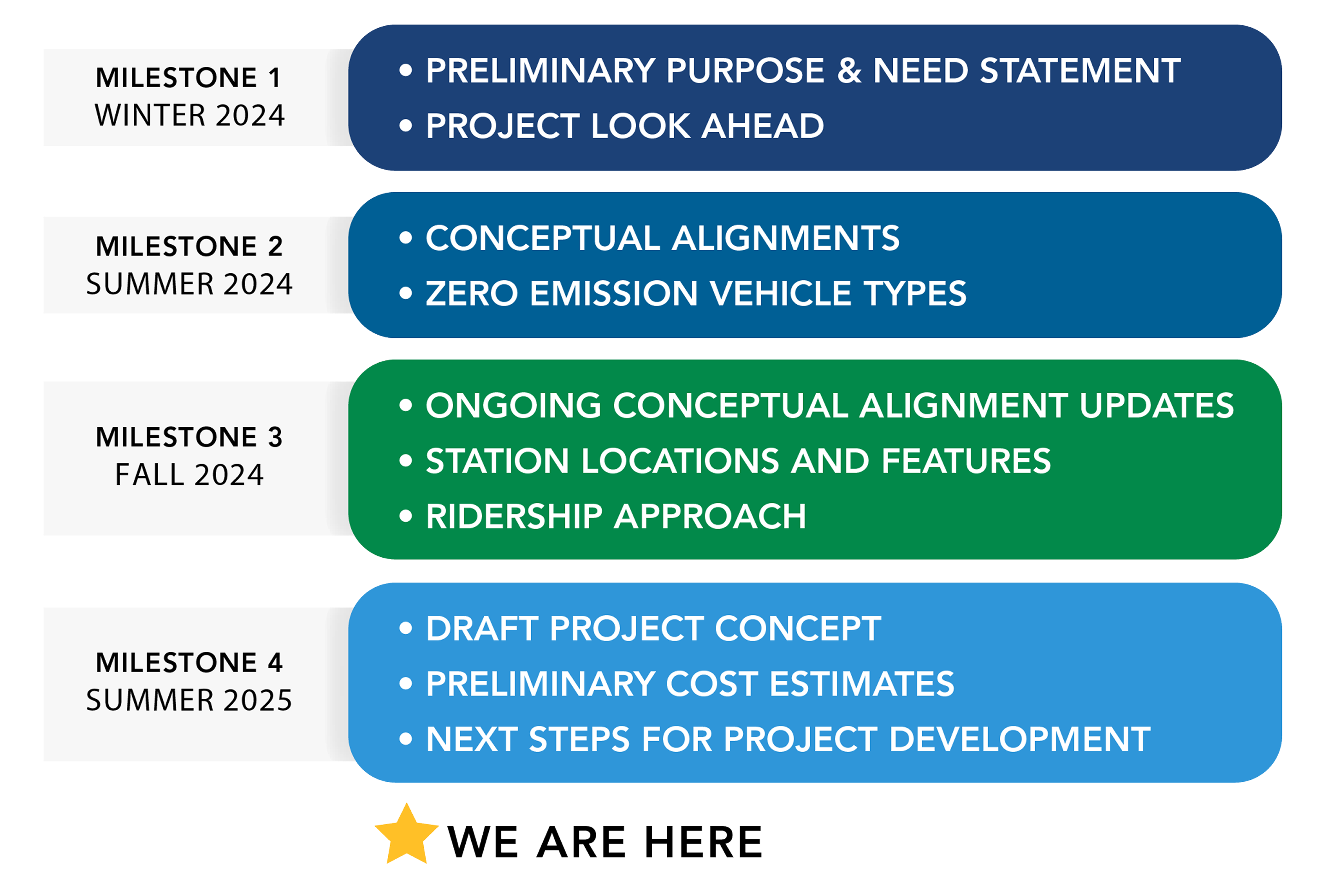
The ZEPRT Final Project Concept Report was completed in mid-October 2024 and is now available to the public. This phase of work progressed through four key milestones, presented in the figure to the right, and included the following tasks:
With the RTC Commission’s approval, and subject to available funding, the ZEPRT project can advance to preliminary engineering and environmental review in future phases, including stand-alone projects of independent utility.
 Click to enlarge
Throughout all milestone activities, meaningful, proactive and focused public and stakeholder engagement occurred, including virtual and in-person meetings.
The following potential future next steps would help inform and progress future ZEPRT project activities, providing further clarity on how the project can serve Santa Cruz County as well as additional information for the RTC Commission to as it makes future decisions regarding project funding and implementation alternatives:
The ZEPRT Project must reflect a transportation investment that balances merit criteria for both federal U.S. Department of Transportation (USDOT) discretionary grant programs and California state competitive funding programs. As funding landscapes shift at both levels, ZEPRT’s multi-benefit approach must evolve for continued investment. Pursuing future funding will require navigating the differences in how federal and state agencies define project value and long-term public benefit.
Recent shifts in federal programs signal an emphasis on priorities such as economic development, safety and cost-effectiveness. At the state level, ZEPRT remains consistent with California’s funding priorities under the discretionary Transit and Intercity Rail Capital Program (TIRCP) and other Senate Bill (SB) 1 funding programs.
Moving forward, it will be critical to strategically consider differing audience priorities to ensure funding pursuits clearly reflect each program’s merit criteria while maintaining a consistent long-term vision for sustainable, multimodal mobility in Santa Cruz County. For funding opportunities at both state and federal levels, ZEPRT will require a detailed Benefit-Cost Analysis (BCA) to monetize and quantify project benefits such as travel time savings, reduced collisions and operational efficiencies. While a benefit cost analysis requires monetization of specific benefits from infrastructure investment, federal and state funding applications must also highlight intangible social benefits for communities.
To dive deeper into potential next steps and funding opportunities for the ZEPRT project, refer to Chapter 20 of the Final Project Concept Report, located on the project webpage at sccrtc.org/zeprt under the “Resources” section.
RTC and its project partners are committed to meaningful public engagement throughout the project’s lifecycle. Community participation is vital in minimizing impacts while meeting the needs of riders, bicyclists and pedestrians.